


SERDIC TwinVision , web-based XR solution
-
Payment
T/T
-
MOQ
1 ea
-
Supply Ability
9,999,999 ea per One-Time
-
Supply Details
Customization
Negotiable
-
Country of sale
Asia, Middle East, Europe, Americas, World Wide
-
PRICE
-
FOB
USD 30,000.00 ~ 300,000.00
(1 ea)
-
ITEM SPECIFICS
-
Brand
Model Flooding Simulation SystemSERDIC
-
origin
Republic of Korea
-
Size(Capacity)
-
-
Style
web-based simulation
-
Gender
All
-
age-appropriate
All
PRODUCT DESCRIPTION
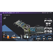
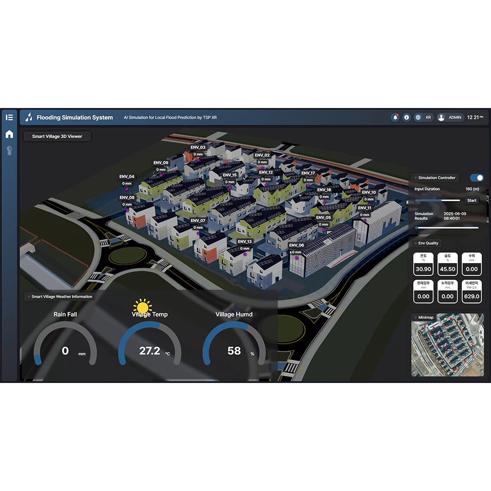
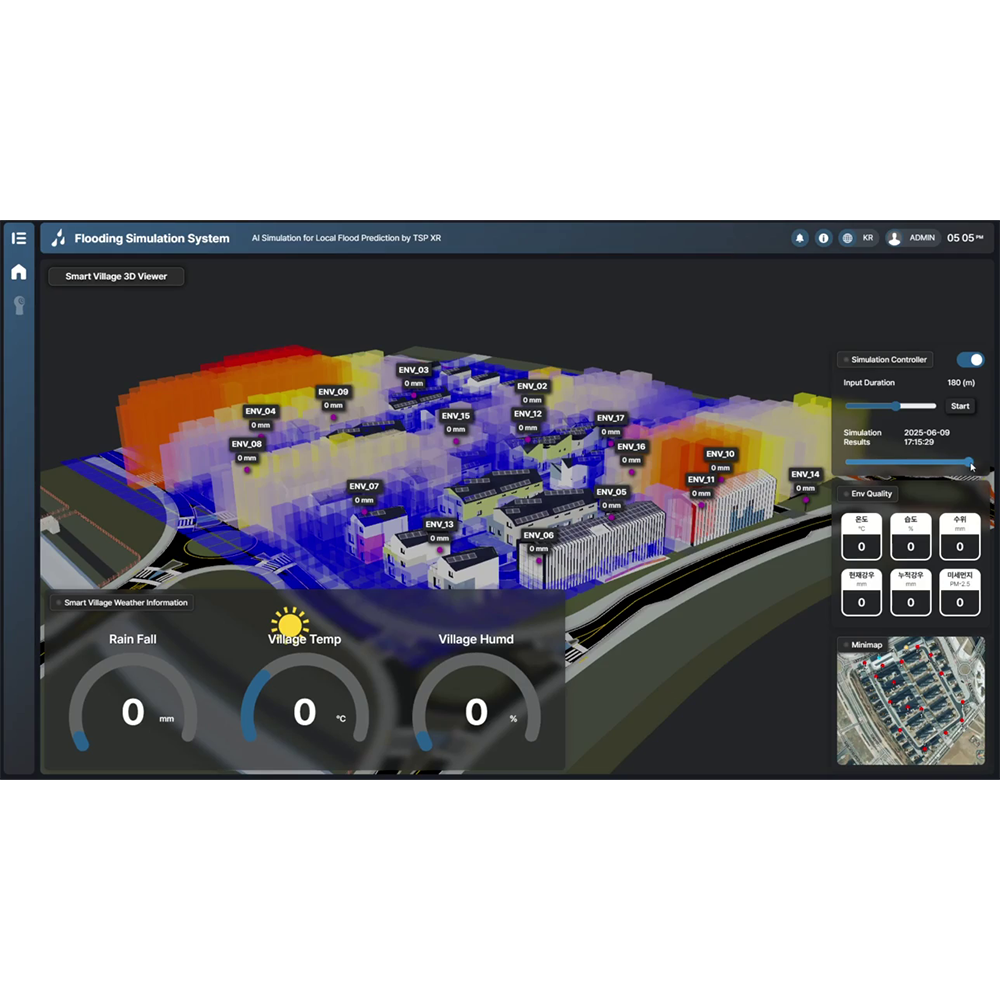
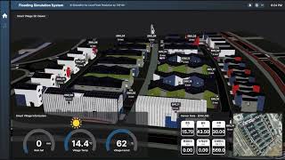
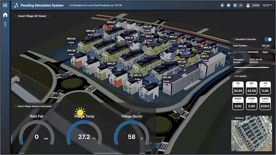
Flooding Simulation System
Service Overview
1. A web-based simulation and prediction solution that visualizes potential flooding based on rainfall data and hydrological modeling.
2. Integrates topographic and infrastructure design data (e.g., DEMs, drainage pipes, retention basins) to simulate surface runoff and water flow in real time.
3. Uses a physical engine to render realistic flood progression dynamically and interactively on screen.
2. Integrates topographic and infrastructure design data (e.g., DEMs, drainage pipes, retention basins) to simulate surface runoff and water flow in real time.
3. Uses a physical engine to render realistic flood progression dynamically and interactively on screen.
Key features
1. Sensor-Integrated AI Prediction
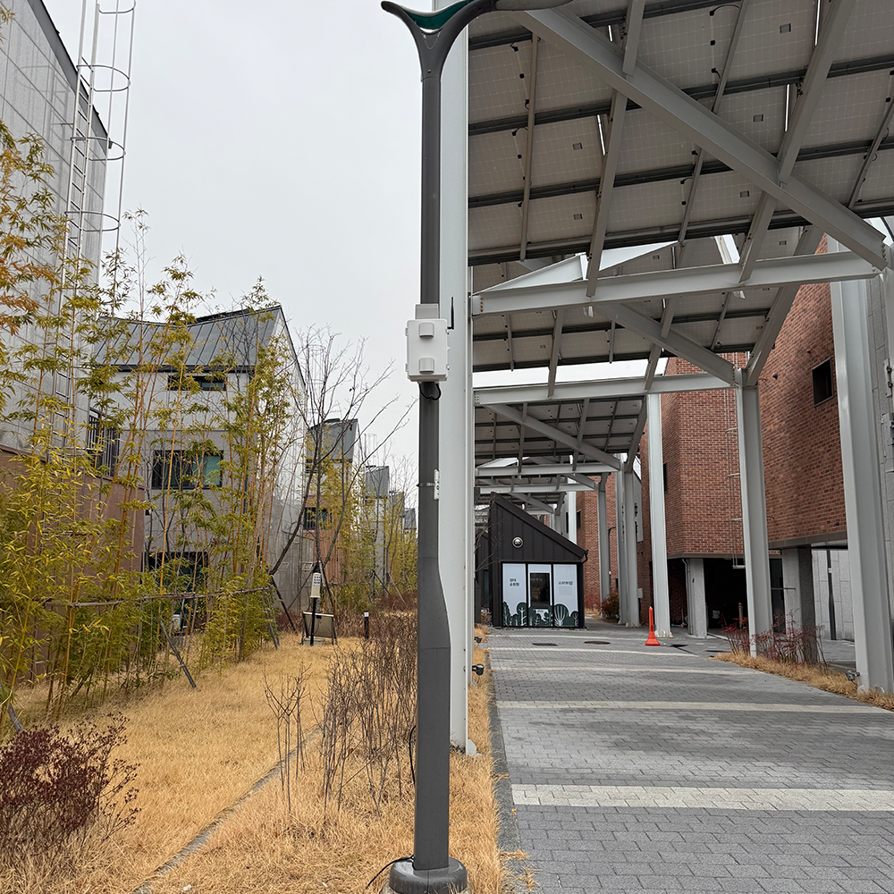
AI utilizes multi-sensor data (e.g., water level, water quality, weather) to enhance prediction accuracy and correct for missing or abnormal sensor inputs in real time.
2. Web-Based SWMM Simulation Engine
Allows hydrological simulations directly in a browser without a separate GUI; supports integration of rainfall, design, and 3D data to generate flow and water level results.
3. GIS + Digital Twin Visualization
Simulation results are visualized as graphs and maps within a web-based digital twin platform. Users can interactively view changes in water levels, flow, and environmental parameters.
4. Real-Time Data Synchronization
Supports API integration with smart city data (e.g., climate, environment, sensors) and dynamically adjusts simulation conditions based on real-time changes.
5. Micro-Scale Analysis with PINN
Applies Physics-Informed Neural Networks to simulate localized components (e.g., pipes, manholes) with high granularity.
Advantages
1. Localized and Real-Time Simulations
Unlike traditional toolsthat focus on pre-construction design, this system adapts to real-world conditions using real-time sensor input and micro-scale data.
2. Data Fusion & Accuracy
Combines micro (local sensor) and macro (public/environmental) data for enhanced predictive performance and contextual awareness.
3. Lightweight & Scalable Web Platform
Runs entirely on the web, eliminating the need for expensive software licenses or installation. Supports quick updates and flexible customization.
4. Powerful Visualization with Digital Twin Integration
Visualizes fragmented smart city data (from sensors, public agencies, and EDC collaborators) in a unified, interactive format, enhancing citizen awareness and preparedness.
5. 5G and AIoT Synergy
Leverages ultra-low-latency 5G networks to transmit and analyze high-volume environmental data collected from multiple sensors simultaneously.
FAQ
Q1. Do I need to install any software to run simulations?
A1. No, the system runs fully on the web and requires no installation.
A1. No, the system runs fully on the web and requires no installation.
Q2. Can I integrate real-time sensor data into the simulation?
A2. Yes, the platform supports API integration with smart city sensors and environmental systems.
Q3. Is the simulation accurate in changing weather conditions?
A3. Yes, the AI automatically adjusts predictions based on multi-sensor input and fills in missing data for consistent results.
Q4. Can I simulate small areas like specific manholes or pipes?
A4. Yes, using PINN-based micro-simulation, the platform supports highly localized modeling.
Company Overview
SERDIC is an innovative startup developing a web-based Digital Twin platform, AI agents, and simulation technologies to enable efficient digital transformation across industrial sites.
With a focus on simplifying and accelerating industrial digitalization, SERDIC offers a modular suite of transformation solutions tailored for seamless integration. By combining AIoT with data-driven AI technologies, the platform delivers real-time monitoring, anomaly detection, predictive maintenance, and simulation-based visualization — all within a single, web-accessible Digital Twin environment.
With a focus on simplifying and accelerating industrial digitalization, SERDIC offers a modular suite of transformation solutions tailored for seamless integration. By combining AIoT with data-driven AI technologies, the platform delivers real-time monitoring, anomaly detection, predictive maintenance, and simulation-based visualization — all within a single, web-accessible Digital Twin environment.
PAYMENTS DETAILS
This supplier supports payments for offline orders
- Telegraphic Transfer : T/T
- Name : Jinkyu Kang
SHIPPING
Shipping from :
Republic of Korea
- 23 Seokgye-ro 18-gil, Nowon-gu, Seoul (01886)
SERDIC Inc.
The person in charge
Jinkyu KangAddress
23 Seokgye-ro 18-gil, Nowon-gu, Seoul (01886)
Introduction
SERDIC is an innovative startup developing a web-based Digital Twin platform, AI agents, and simulation technologies to enable efficient digital transformation across industrial sites.
With a focus on simplifying and accelerating industrial digitalization, SERDIC offers a modular suite of transformation solutions tailored for seamless integration. By combining AIoT with data-driven AI technologies, the platform delivers real-time monitoring, anomaly detection, predictive maintenance, and simulation-based visualization — all within a single, web-accessible Digital Twin environment.
-
- Business Type :
- Knowledge Service
-
- Main Product :
- Web-Based Digital Twin Platform and AI Solutions
-
- Established :
- 2021-05-24
-
- Total Annual Revenue :
- 3~5 million (KRW)
-
- Total Employees :
- 5~10 people
COMPANY ENVIRONMENT

Please suggest a variety of your ideas such as design, impact, enhancements, etc
Captcha Required
Please enter the text on the left image to prevent automatic input.
0 / 4000
질문이 없습니다.
CUSTOMER REVIEWS (0)

TRADE EXPERIENCE
-
- Total revenue
- 3~5 million (KRW)
-
- Total export revenue (previous year in USD)
-
- Number of foreign trade employees
- 5~10 people
COMPARISON TO SIMILAR ITEMS more
- No Items
- supplier level
- MEMBER
- SERDIC Inc. Seller's Store
- Seller's Store url
- Response Level
★ ★ ★ ★ ★

- Supplier Level
★ ★ ★ ★ ★
- Transaction Level
★ ★ ★ ★ ★
SUPPLIER BEST